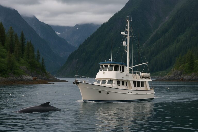
Southeast Alaska offers one of the most rewarding wilderness cruising grounds in North America, but running a trawler here demands a different mindset than coastal hops in lower latitudes. Its islands, channels and fjords make it valuable to define a manageable area and identify the support available along the proposed trip. A successful maiden voyage to the Panhandle does not depend on a rigid daily schedule. Instead, it relies on building an itinerary around predictable support hubs, seasonal wildlife protections, and changing marine weather.
For skipper and crew, planning begins by defining the scope of the voyage, establishing realistic staging stops, and configuring the boat for weeks of self-sufficient anchorages.
Defining the Scope: The Southeast Inside Passage
Southeast Alaska, colloquially known as the Panhandle, is fundamentally different from Southcentral Alaska, the Gulf of Alaska, or the Aleutian Chain. An itinerary in the Southeast Inside Passage should be planned as a particular regional trip, rather than treated as a guide to every Alaska cruising area.
Start by choosing the area you want to explore and the dates you can realistically allow. Match that choice to current regional forecasts, harbor arrangements, park requirements and the crew’s experience. A season label cannot determine the conditions for a particular passage.
If your trip includes the transit north along British Columbia’s coast, separate that journey from the time available to explore Southeast Alaska. Cruising North With a Trawler: Planning Fuel, Weather, and Remote Stops Beyond the San Juans develops those broader transit logistics. Resolve the applicable border and arrival requirements for your actual route.
Building Stages Around Candidate Ports and Weather Buffers
Treat Southeast Alaska towns as operational staging areas rather than fixed hotel reservations. The available berth and services may be shared with commercial activity and other visitors. Confirm what is available for your boat and dates rather than assuming a stop will provide every service.
Compare candidate towns against the support your trip actually needs. Official harbor information is a useful starting point:
| Candidate | Planning Use | What to Confirm |
|---|---|---|
| Ketchikan | Investigate the city’s public harbor arrangements | Registration, assigned berth and required services |
| Petersburg | Investigate harbor access and shoreside needs | Moorage, access and support for the intended stay |
| Sitka | Investigate harbor and provisioning arrangements | Assigned space, access and current service availability |
Allow time between support stops based on measured consumption and the proposed route. Keep room for weather delays, changed harbor arrangements and rest. Avoid commitments that force departure merely to meet a guest’s flight or reservation.
Regional Forecasts and Hydrographic Realities
Use regional information that covers the actual channels, approaches and exposed parts of the trip. Broad forecasts alone may not answer every local question.
Skippers should monitor the National Weather Service forecast office in Juneau, which generates regional Southeast Alaska marine forecasts covering the specific internal straits, sounds, and cross-passages. The Juneau office provides regional forecast graphics, text products and observation links. Compare those resources with current charts and the relevant tide and current information. Identify exposed or constrained stages before deciding how they fit the trip. Weather-Window Planning for Pacific Northwest Coastal Hops offers a separate planning framework; it does not provide an Alaska passage schedule.
Do not adopt a universal tide or current speed, or assume every restricted passage should be transited at slack water. Timing and suitability require information for the actual location and boat.
Because deep, narrow fjords often block both cellular connectivity and line-of-sight VHF signals to shore stations, your onboard setup must be resilient. Use Navigation and Communications Redundancy for Remote Cruising to assess information and communication options appropriate to the trip. Do not assume coverage or immediate help will be available.
Wildlife Restraint and Glacier Bay Planning
Southeast Alaska is a functioning marine ecosystem where humpback whales, orcas, sea otters, Steller sea lions, and brown bears feed actively throughout the summer. Encountering these species from the deck of a trawler is an undeniable highlight of the voyage, but keeping wildlife wild requires strict operational restraint.
Federal regulations protect marine mammals from vessel disruption. Review regional marine wildlife viewing guidance before departure. Rules and guidance vary by species and location, so do not treat one distance or maneuver as a complete answer. Avoid pursuing or disrupting wildlife and keep observation subordinate to navigation and proper lookout.
Glacier Bay Entry and Permits
Visiting Glacier Bay National Park and Preserve requires advance administrative planning. As checked in October 2026, the National Park Service requires private-vessel permits during the specified summer period for the designated Glacier Bay waters, along with orientation and operating requirements. The 2026 online permit system is a pilot.
Review Glacier Bay private boating requirements for the season of your actual visit before building the stop into the itinerary. Confirm application procedures, permit area, orientation, entry/exit contact requirements and current operating restrictions. A desired arrival date does not establish permit availability.
Living Aboard: Balancing Support, Tankage, and Helm Comfort
Time between shore stops depends on the itinerary and conditions. Plan domestic use and crew comfort alongside fuel and access to services.
Provisioning and Domestic Management
-
Waste: Reduce unnecessary packaging and confirm disposal opportunities. Keep waste contained until suitable facilities are available.
-
Freshwater: Use actual consumption and confirmed replenishment options. If a watermaker is part of the plan, allow for periods when it is unavailable.
-
Power: Compare actual loads with charging options and time available; weather and use patterns can change replenishment.
Yacht Configuration and Helm Utility
When reviewing our current models, consider the living arrangement, helm visibility, equipment access and storage relevant to your proposed trip. Discuss the actual configuration rather than assuming regional suitability from a model name.
A sheltered helm can reduce direct exposure to rain and wind. It does not change the sea state or the vessel’s limits. Maintain proper lookout by sight, hearing and the available means appropriate to the circumstances; that requirement does not prescribe one fixed watchkeeping position.
Evaluate ground tackle and other equipment for the actual boat, anchorage and conditions rather than assuming a universally oversized anchor or all-chain arrangement is the answer.
Finalizing Your Route
Planning a maiden trawler voyage to Southeast Alaska is an exercise in flexibility. Design an itinerary that covers modest distances, leaves generous room for weather holds, respects the regulatory boundaries of national parks, and prioritizes self-sufficiency at anchor.
Every trawler, crew configuration, and personal cruising timeline is different. We invite you to talk with us about your regional route ideas, living space priorities, and outfitting requirements as you prepare your yacht for the Inside Passage.