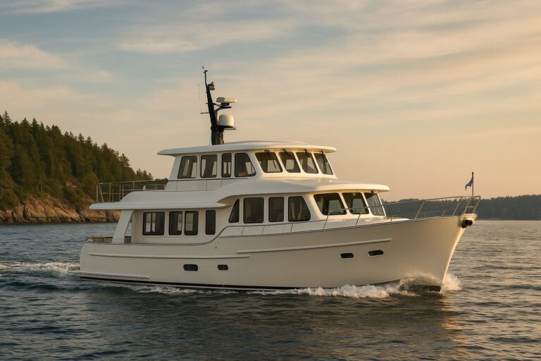
Dropping anchor at an isolated island requires a total shift from marina-hopping habits to true self-reliance. Distance offshore matters far less than the gap between your deck and the nearest haul-out yard, fuel dock, or fresh water supply. When you step off the grid to explore outer coastlines, consider how the boat and crew will manage time between dependable shore services, including a change in plans.
Before pointing your bow toward an unserviced island, you need to answer five core questions about safety margins, daily consumption, and shore access.
How Remote Is the Island in Practical Terms?
An island’s remoteness is measured by travel time to dependable assistance, not straight-line mileage from your home slip. A location thirty miles from a major metro area can be functionally isolated if surrounding waters feature strong currents, shallow bars, or headlands that block VHF communications.
To determine the real support gap, identify three critical locations before casting off:
-
The nearest dependable commercial support: Note the closest port with a functional fuel dock, pump-out station, marine mechanics, and a travel lift capable of handling your boat’s beam and displacement.
-
Medical assistance: Understand how to contact appropriate help for the area and which access options are realistically available; do not assume immediate evacuation or response.
-
A viable secondary harbor: Identify an alternative, protected anchorage situated in a different exposure angle from your primary destination. If an unpredicted swell rolls into your chosen cove at 0200, you need a pre-charted route to shelter that does not require entering an uncharted inlet in the dark.
Evaluating long passages along rugged coastlines involves deep logistical planning. While our guide on Cruising North With a Trawler: Planning Fuel, Weather, and Remote Stops Beyond the San Juans covers extended coastal legs, short island crossings require the same disciplined approach to fallback destinations. Pair that geographic planning with Navigation and Communications Redundancy for Remote Cruising to consider independent ways of obtaining information and contacting help. Coverage and emergency response cannot be assumed, especially behind terrain or far from support.
Does Your Measured Consumption Match Installed Capacities?
Theoretical burn rates and tank capacities on a spec sheet do not reflect reality at an isolated anchorage. Self-sufficiency requires tracking actual, measured consumption across your crew and mechanical systems over multi-day periods.
| System | Planning Factor | Operational Reality to Account For |
|---|---|---|
| Fuel | Main engine burn rate at displacement speed | Generator run-time under load, heating system draw, windage resistance in heavy chop, and running against tidal gates |
| Freshwater | Gallons consumed per person per day | Galley cleanup, anchor washdowns, engine room top-offs, and watermaker pre-filter clogging from coastal plankton blooms |
| Electrical | House battery capacity in amp-hours | Refrigeration cycles in warm air, inverter efficiency losses, stabilization system power, and consecutive overcast days limiting solar input |
| Provisions & Waste | Usable dry and refrigerated stowage | Blackwater holding capacity, greywater restrictions in pristine bays, and managing sealed, odor-free trash aboard |
Base your fuel calculations on total distance, anticipated auxiliary generator hours, and the transit to your secondary bailout port, using verified historical burn rates under load rather than idealized factory estimates.
Freshwater demands equal scrutiny. If your yacht carries a watermaker, understand its installed power, maintenance and water-quality requirements. Carry suitable supplies and plan for periods when it is unavailable. Your freshwater plan should remain workable without treating daily watermaking as guaranteed.
Can You Legally and Physically Go Ashore?
Securing a solid anchor hold in a protected cove does not mean you have access to the island itself. Jurisdictions, environmental protections, and shorelines vary widely from island to island, often turning an anticipated shore excursion into boat-bound observation.
National parks, state preserves, and privately held islands frequently enforce strict landing rules. For example, official Channel Islands boating guidance demonstrates that access regulations are highly variable: specific islands demand landing permits, sensitive bird and seal rookeries trigger seasonal shoreline closures, and the entire park offers zero public moorings and no guaranteed all-weather anchorages.
Beyond legal permissions, evaluate physical tender access:
-
Beach topography: Steep cobblestone or gravel beaches with surging shore break can easily flip a rigid inflatable boat (RIB), even when conditions appear settled at the boat.
-
Tidal swings: Anchoring the tender on an extreme low tide can leave your dinghy stranded high and dry, while a rising tide can swamp a skiff tied to an unmonitored shore line.
-
Dock infrastructure: Primitive skiff docks or pier pilings on remote islands are often built for commercial workboats, leaving them missing fenders, ladders, or low-water floats suitable for recreational tenders.
Plan for the reality that surf or sheer cliffs may trap your crew aboard the trawler for the duration of the visit.
What Triggers an Immediate Change of Plan?
Entering an undeveloped anchorage requires pre-set operational limits. Coastal weather shifts quickly around island landmasses, which create their own microclimates, funneling winds through passes and wrapping ocean swell around outer points.
Establish clear trip-wire conditions before departure using official marine forecasts and float plans to inform your crew and your emergency shore contacts. Identify which changes would prompt a reassessment, such as a different wind or swell direction, reduced access to shelter, or a crew or equipment problem. Set criteria appropriate to the boat, place and conditions; a universal wind-angle or pressure threshold cannot determine the right action.
Inability to land the tender or maintain planned communications may change what is practical, but it does not automatically mean departing into worse conditions. Review your options with the available weather and local information. Agree on a float plan and missed-check-in process with a trusted shore contact, including whom they should contact if concerned.
Does Your Yacht Match This Specific Mission?
Every cruising platform represents a series of engineering trade-offs between living volume, tank capacity, mechanical access, and deck functionality. Assessing your trawler for an unsupported island trip means looking critically at how those trade-offs perform when there is no dock to bail you out.
Consider the practical demands of the destination against your boat’s layout:
-
Ground tackle setup: What bottom conditions, depths and exposure are expected at the intended anchorage, and is your ground tackle appropriate? Review equipment limits and the options available if the first choice does not work.
-
Tender management: Evaluate the installed tender-handling arrangement for its load limits and the conditions; do not assume a particular crane or davit is appropriate. Hand-launching tenders or wrestling outboards across a wet swim platform becomes hazardous the moment an unexpected swell enters the bay.
-
Machinery space layout: Consider access to installed equipment, the supplies you can carry and the tasks you are competent to perform. A fault may require professional help or a change of trip; do not make remote repairs an assumed obligation.
-
Operating station limits: While a protected pilothouse can reduce direct exposure to weather, an enclosed helm does not permit running through deteriorated sea conditions, nor does it replace a vigilant lookout scanning for floating timber, pot buoys, or breaking reef heads.
Exploring our current models gives you an overview of how we arrange machinery spaces, tank integration, and living ergonomics across our trawlers. Yet boat-fit is never one-size-fits-all. The right equipment array for a week spent swinging on the hook depends entirely on where you cruise, the seasonal conditions of the region, and the skills of your crew.
If you are planning voyages beyond standard marina infrastructure, talk with us about your regional goals, layout requirements, and onboard equipment priorities so we can help you evaluate what setup best supports your time at anchor.