Cruising the Florida Keys is less about running an open coastal highway and more about connecting distinct island environments. The archipelago arcs southwest from the southern tip of mainland Florida to Key West, bounded by shallow Florida Bay to the north and the Atlantic barrier reef tract to the south. Experiencing this chain from the water works best when you treat the Upper, Middle, and Lower Keys as separate destinations, each presenting distinct shore logistics, natural sanctuaries, and maritime histories.
Distinct Cruising Ground: Upper, Middle, and Lower Keys
The Florida Keys do not offer uniform harbor access or continuous deep water for a cruising yacht. Depths shift rapidly between Atlantic waters and the shallow inland flats, meaning a named park or historic site rarely comes with an automatic yacht dock.
The Upper Keys, centered around Key Largo and Islamorada, focus on living barrier reefs, marine state parks, and protected coastal hammocks. The Middle Keys offer another focus for marina stays and island shore days. The Lower Keys taper into quiet mangrove outposts before terminating at the compact, walkable street grid of Key West. Rather than attempting to bring a yacht alongside every natural point of interest, the most rewarding strategy pairs a confirmed berth or separately planned anchorage with tenders, local excursions, or shoreside transport to reach the islands themselves.
Key Largo: Reef Excursions and Shore-Side Operations
Key Largo offers the region’s most direct connection to living coral communities, centered on John Pennekamp Coral Reef State Park. The park manages a vast expanse of offshore Atlantic waters, sheltering shallow patch reefs, mangrove channels, and underwater places to explore.
A park excursion can make a reef day part of your trip without moving the yacht to an offshore site. Choose among glass-bottom boat tours, snorkeling, and scuba diving according to your group’s interests. Confirm your regional berth and ground transport to the park separately, or ask the park about its current boating facilities if you want to arrive by water.
If you plan to stage a tender or vehicle at the park, verify facility status in advance. A construction notice effective July 22, 2026, closes one boat ramp and the pump-out station and reduces boat-trailer parking; recheck the notice for your dates.
Islamorada: Preserved Hammocks and Saltwater Heritage
Islamorada is defined by sportfishing heritage and rare botanical preservation. While modern sportfishing centers line the ocean and bay approaches, the cultural standout is Lignumvitae Key Botanical State Park, positioned on the Florida Bay side of the island chain.
Lignumvitae Key preserves a virgin tropical hardwood hammock that once covered the upper islands prior to logging and agriculture. The island is accessible exclusively by boat or kayak, with no bridge or vehicle link to the Overseas Highway. Plan the boat connection with park staff or a local operator; boat-only access does not establish a suitable landing for every yacht. Interior hammock access is managed separately from the lawn and historic house area.
Visitor services on the island require direct verification before setting out. Ranger-led tours are currently listed as unavailable, while a self-guided brochure covers the Matheson home and lawn features. Check current landing protocols and open days with park staff before dropping a tender.
Key West: Historic Town Days from Key West Bight
Key West shifts the focus from offshore nature preserves to dense maritime history, architecture, and dining. For yacht owners seeking a walking base in the historic district, Key West Bight Marina provides a municipal transient facility directly inside the harbor.
Securing a berth at the Bight places Old Town at the foot of your dock. Mel Fisher’s maritime museum, the Custom House, historic homes, and waterfront dining sit within easy walking distance, making a walking day an appealing option. Check dockage for the dates you want. The marina accepts inquiries based on specific vessel dimensions, including length overall, beam, and draft; reservations must be confirmed well before arrival, as transient berths are never guaranteed on a drop-in basis. Allow shore time for the island’s naval and salvage history as well as your provisioning plans.
Dry Tortugas: A Self-Sufficient Remote Commitment
Located roughly 70 miles west of Key West, Dry Tortugas National Park is a dedicated open-water passage, not a casual day excursion. The park encompasses seven remote sand keys anchored by Fort Jefferson, a massive 19th-century brick coastal fortress surrounded by clear waters and protected coral shelves.
Visiting with your own vessel requires complete self-sufficiency. The park provides no fuel, fresh water, provisions, shore power, or public garbage disposal. Every scrap of refuse brought into park waters must be packed out upon departure. Follow the current National Park Service boat-permit instructions on arrival at Garden Key. Overnight anchoring is limited to sandy-bottom areas within one nautical mile of the Garden Key lighthouse, with closed areas and channels excluded; check the park map and current restrictions before deciding where to stay.
Park regulations strictly prohibit private vessel dockage at neighboring Loggerhead Key, and specific research zones restrict access across the outer banks. If open-water sea conditions, mechanical readiness, or operational preferences argue against a private crossing, commercial high-speed catamarans and seaplanes run out of Key West, offering an efficient day visit to Fort Jefferson without committing your yacht.
Protecting the Living Reef: Marine Sanctuary Buoys and Regulations
The Florida Keys National Marine Sanctuary protects extensive waters around the island chain. Operating here requires strict adherence to habitat protection rules designed to protect shallow hardbottom communities and living corals.
NOAA maintains an extensive system of round mooring buoys across high-use reef tracts as an alternative to anchoring that can damage coral. Anchoring on living coral is prohibited by federal law throughout the sanctuary. If no suitable mooring is available, NOAA allows anchoring in sand away from coral and seagrass only outside no-anchor zones and subject to the rules of the particular location. Mooring buoys are not one-size-fits-all hardware; confirm that a specific buoy is appropriate for your vessel and conditions before using it. Always confirm current sanctuary regulations and zone boundaries before entering sensitive reef units.
Practical Route and Passage Preparation
A Keys itinerary requires meticulous passage management rather than casual coastal wandering. Depths drop and rise abruptly, and tidal currents run hard through narrow highway spans. Use current electronic navigational charts and review Local Notices to Mariners. NOAA Custom Charts provide another way to create chart material from current NOAA ENC data. Weather also drives the calendar: the Atlantic basin hurricane season runs from June 1 through November 30, though severe low-pressure systems can develop outside those dates. Cold fronts can also affect winter plans, so leave flexibility for conditions and confirm marina arrangements for your actual dates.
Matching Onboard Routine to Island Realities
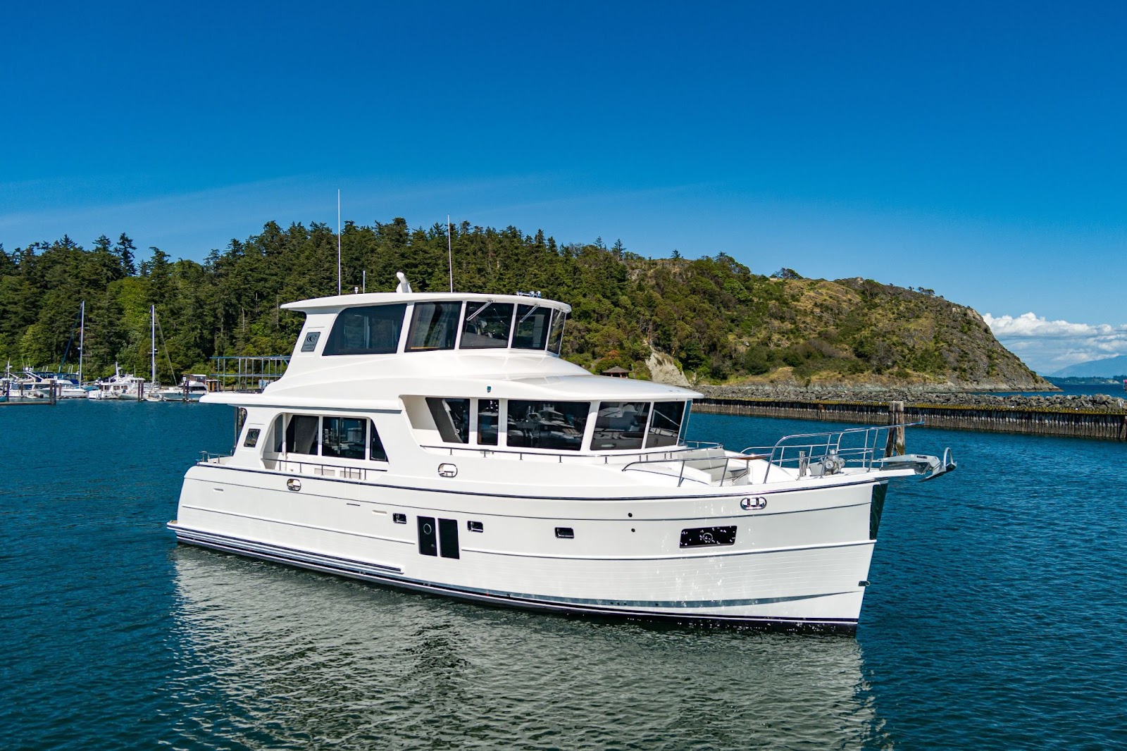
The Keys reward vessels that make tender deployment straightforward and offer reliable shade for long days off the dock. Comparing regional realities in our destination guides can help you weigh the distinct pacing of this shallow coral archipelago against other coastal routes. When you are ready to evaluate slip requirements, tender ranges, and the right layout for your personal cruising plans, talk with us about how your vessel fits your travel ambitions.
Sources
- John Pennekamp Coral Reef State Park
- Lignumvitae Key Botanical State Park
- Key West Bight dockage
- Dry Tortugas directions
- Dry Tortugas compendium
- Dry Tortugas boating
- Florida Keys sanctuary buoy program
- Florida Keys sanctuary regulations
- NOAA Custom Charts
- NHC tropical cyclone climatology
- Dry Tortugas food, water and fuel